Summary
Country trails across the United States offer more than scenic walks—they reflect the culture, landscape, and history of each region. From Appalachian forest paths to Western desert routes and Midwestern prairie corridors, these trails reveal how geography shapes local life. Exploring them provides a practical way to understand rural America while enjoying accessible outdoor recreation.
Why Country Trails Tell the Story of a Region
Across the United States, country trails provide a quieter alternative to crowded national park routes. Many of these paths run through farmland, forest edges, river valleys, and rural communities. They are shaped by geography, agriculture, and local traditions, which means the experience of walking a trail in Vermont feels very different from exploring one in Arizona or Kansas.
Country trails are often built on historic corridors—old wagon roads, rail lines converted into trails, or routes once used for farming and trade. According to the Rails-to-Trails Conservancy, the U.S. has more than 40,000 miles of multi-use rail-trails, many passing through rural landscapes that reflect regional identity.
For travelers and outdoor enthusiasts, these trails offer a practical way to experience the character of rural America without requiring advanced hiking skills. Many are well-maintained, relatively accessible, and suitable for walking, biking, or horseback riding.
The Northeast: Forest Paths and Historic Countryside
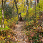
In the northeastern United States, country trails often weave through hardwood forests, colonial farmland, and small towns that date back centuries. Stone walls, maple trees, and covered bridges frequently appear along these routes, giving hikers a sense of the region’s long settlement history.
One well-known example is the Kingdom Trails in Vermont’s Northeast Kingdom. Though famous for mountain biking, many sections also provide scenic walking routes through farmland and forest.
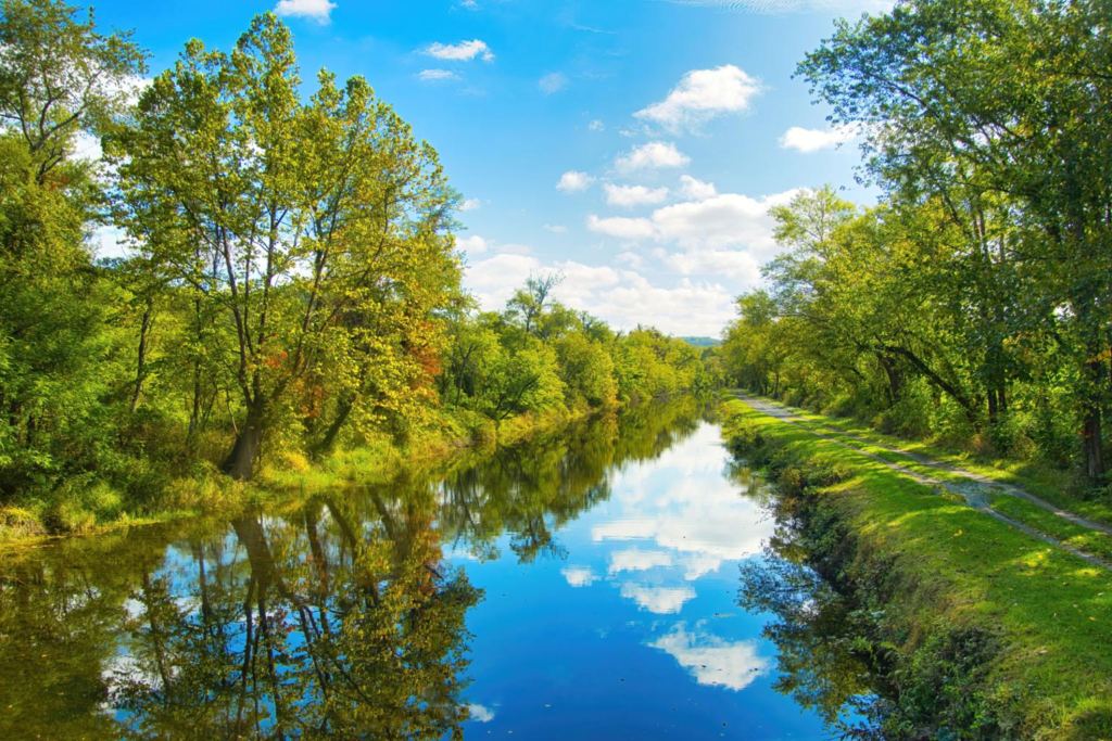
Further south, the C&O Canal Towpath follows the Potomac River for 184 miles. Originally used by mules pulling canal boats, the path now offers a quiet corridor through forests, riverbanks, and historic canal structures.
These northeastern trails often highlight:
- Mixed hardwood forests with seasonal color changes
- Historic infrastructure, including canal locks and farm roads
- Compact rural towns within walking distance of trails
Because the region has older infrastructure and dense settlement patterns, country trails here often connect communities rather than remaining isolated in wilderness.
The Southeast: Trails Through Rural Heritage Landscapes
Country trails in the Southeast tend to move through rolling hills, pine forests, and farmland shaped by agriculture and rural communities. The pace of these trails often feels slower, with scenic farmland views and historic homesteads along the way.
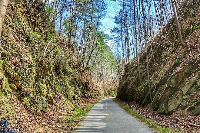
A notable example is the Virginia Creeper Trail. Running 34 miles from Abingdon to Whitetop Station, the trail passes through farmland, mountain streams, and small Appalachian towns. It follows a former railroad corridor and is widely used by cyclists and walkers.
In Georgia, the Silver Comet Trail stretches more than 60 miles across rural landscapes and eventually connects to Alabama’s Chief Ladiga Trail. The route reveals the region’s mix of wooded countryside and agricultural land.
Typical characteristics of Southeastern country trails include:
- Forest canopies of pine, oak, and tulip poplar
- Routes following former railroad corridors
- Trail towns with locally owned cafes and small businesses
These trails provide insight into rural Appalachian and Southern landscapes while remaining accessible to casual outdoor travelers.
The Midwest: Prairie Corridors and Rail-Trail Networks
The American Midwest offers a different trail experience. Instead of forested hills, many country trails stretch across prairies, farmland, and open skies. Because the region historically relied heavily on railroads, many trails today follow converted rail corridors.
The Katy Trail State Park is one of the longest rail-trails in the United States, running 240 miles across Missouri. The trail parallels the Missouri River for long stretches and passes vineyards, farmland, and small river towns.
Another example is the Root River State Trail, which moves through southeastern Minnesota’s limestone bluffs and rural communities.
Midwestern trails often stand out because of:
- Long-distance, relatively flat routes ideal for biking
- Wide-open agricultural landscapes
- Small-town trail hubs that support rural tourism
According to the National Park Service, rail-trail conversions have become a key strategy for preserving historic transportation corridors while expanding recreation opportunities.
The Mountain West: High Elevation and Expansive Landscapes
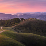
Country trails in the Mountain West often feel more remote and dramatic than those in other regions. Elevation, geology, and wildlife shape the experience. Trails may cross alpine meadows, sagebrush valleys, and foothill ranchlands.
One example is the Rio Grande Trail, which stretches 42 miles between Aspen and Glenwood Springs. It follows the Roaring Fork River and provides sweeping views of the Rocky Mountains.
In Idaho, sections of the Trail of the Coeur d’Alenes cross forests, lakes, and wetlands over a 73-mile route built on a former railroad corridor.
Mountain West country trails often feature:
- High elevation terrain and dramatic scenery
- Wildlife sightings such as elk or mule deer
- Long stretches between towns
For travelers interested in regional identity, these trails reflect ranching culture, mining history, and the wide-open landscapes associated with the American West.
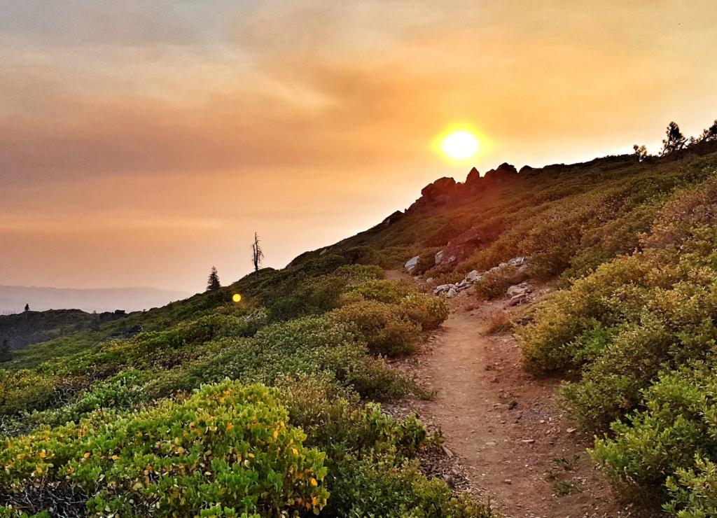
The Southwest: Desert Trails and Cultural Landscapes
In the Southwest, country trails reflect the arid environment and long Indigenous and Spanish settlement history of the region. Trails often pass through desert grasslands, red rock formations, and historic pueblos.
The Santa Fe Rail Trail runs 15 miles through high desert landscapes outside Santa Fe. The route follows an old rail corridor and offers views of mesas and distant mountains.
Arizona’s Prescott Peavine Trail crosses granite outcrops and desert vegetation while connecting the city of Prescott with surrounding countryside.
What distinguishes Southwestern country trails:
- Dry climates and desert ecosystems
- Historic trade routes and rail corridors
- Unique geology such as red rock canyons and mesas
These routes demonstrate how the environment shapes both trail design and rural settlement patterns.
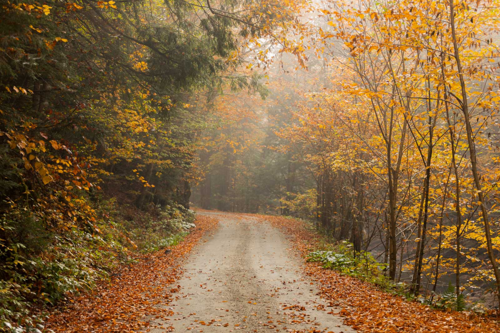
The Pacific Northwest: Forests, Rivers, and Coastal Routes
The Pacific Northwest offers some of the most diverse country trails in the United States. Dense evergreen forests, volcanic mountains, and coastal ecosystems create varied landscapes within relatively short distances.
The Banks-Vernonia State Trail runs 21 miles through Oregon’s Coast Range forests, crossing wooden trestle bridges and quiet logging towns.
In Washington, the Palouse to Cascades State Park Trail spans more than 250 miles, cutting across farmland, forests, and mountain passes.
Typical features of Northwest country trails include:
- Dense evergreen forests and moss-covered landscapes
- Bridges, tunnels, and historic rail infrastructure
- Frequent river crossings and wetlands
These trails reflect the region’s timber heritage, agricultural valleys, and dramatic natural scenery.
What Makes Country Trails Appealing to Modern Travelers?
Country trails are gaining attention because they combine outdoor recreation with cultural exploration. Unlike many backcountry hikes, they often remain accessible to a wide range of users.
Several factors explain their growing popularity:
- Accessible terrain suitable for walking, cycling, or casual exploration
- Connections to rural communities where visitors can experience local culture
- Historic routes that provide context about regional development
- Less crowded environments compared with national park hotspots
Outdoor recreation has grown significantly in recent years. According to the Outdoor Industry Association, more than 168 million Americans participated in outdoor recreation in 2022, and trail-based activities remain among the most popular.
Practical Tips for Exploring Country Trails
Travelers planning to explore regional trails can improve their experience with a few practical strategies.
Before visiting a trail:
- Check local trail conditions and seasonal access
- Bring sufficient water, especially in dry regions
- Research nearby towns for services and lodging
During the visit:
- Follow local trail etiquette and yield rules
- Respect farmland and private property boundaries
- Carry a trail map or offline navigation
After the visit:
- Support local businesses in nearby communities
- Leave reviews or feedback to support trail preservation efforts
These practices help maintain the sustainability of rural trail networks.
Frequently Asked Questions
What are country trails in the United States?
Country trails are recreational paths located in rural areas, often following historic railroads, farm roads, or river corridors. They typically allow walking, biking, and sometimes horseback riding.
Are country trails suitable for beginners?
Many country trails are relatively flat and well maintained, making them accessible for beginners and families.
How long are typical country trails?
Trail lengths vary widely. Some are short community routes of a few miles, while others—like the Katy Trail—extend over 200 miles.
Do country trails require permits?
Most public rail-trails and regional paths do not require permits for day use, though some parks may charge parking or access fees.
What is the difference between a rail-trail and a hiking trail?
Rail-trails are built on former railroad corridors and tend to be wide and gently graded, while traditional hiking trails often involve steeper terrain.
When is the best time to explore country trails?
Spring and fall are popular because of moderate temperatures, though conditions vary by region.
Are country trails safe for cycling?
Yes. Many were specifically designed for multi-use activities including cycling.
How do country trails support rural communities?
They attract visitors who spend money on lodging, dining, and services in nearby towns.
Can you camp along country trails?
Some long-distance trails offer designated campgrounds or nearby state parks, but camping rules vary by location.
Where can travelers find reliable trail maps?
Organizations such as the Rails-to-Trails Conservancy and state park agencies provide detailed maps and trail information.
Why Regional Trails Offer a Unique Window into Rural America
Country trails reveal the character of the United States in subtle but meaningful ways. Walking through maple forests in Vermont, cycling across Missouri farmland, or following a desert rail corridor in New Mexico offers more than recreation—it provides insight into the landscapes that shape American communities.
Each region’s trails reflect its history, environment, and culture. Together they form a quiet but extensive network that connects people not only to nature, but also to the stories embedded in the land.
Key Insights at a Glance
- Country trails reveal the geography and history of different U.S. regions
- Rail-trail conversions have created thousands of miles of accessible routes
- Trails in each region highlight distinct landscapes and cultural traditions
- Rural trail networks support local economies through tourism
- Many country trails are beginner-friendly and suitable for cycling or walking